


089CE - CHAMBLEE (CHA) Voting District, DeKalb County, Georgia
About
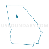
Outline
+Voting+District%2c+DeKalb+County%2c+Georgia_A280.png)
Summary
| Unique Area Identifier | 561142 |
| Name | 089CE - CHAMBLEE (CHA) Voting District |
| County | DeKalb County |
| State | Georgia |
| Area (square miles) | 3.18 |
| Land Area (square miles) | 3.18 |
| Water Area (square miles) | 0.00 |
| % of Land Area | 100.00 |
| % of Water Area | 0.00 |
| Latitude of the Internal Point | 33.88866550 |
| Longtitude of the Internal Point | -84.30362250 |
Maps
+Voting+District in DeKalb County.png)

Graphs
Select a template below for downloading or customizing gragh for 089CE - CHAMBLEE (CHA) Voting District, DeKalb County, Georgia
+Voting+District%2c+DeKalb+County%2c+Georgia_T0.png)
+Voting+District%2c+DeKalb+County%2c+Georgia_T1.png)
+Voting+District%2c+DeKalb+County%2c+Georgia_T2.png)
+Voting+District%2c+DeKalb+County%2c+Georgia_T3.png)
+Voting+District%2c+DeKalb+County%2c+Georgia_T4.png)
+Voting+District%2c+DeKalb+County%2c+Georgia_T5.png)
+Voting+District%2c+DeKalb+County%2c+Georgia_T6.png)
+Voting+District%2c+DeKalb+County%2c+Georgia_T7.png)
+Voting+District%2c+DeKalb+County%2c+Georgia.png)
Neighbors
Neighoring Voting District (by Name) Neighboring Voting District on the Map
- 089AB - ASHFORD PARK ELEMENTARY Voting District, DeKalb County, GA
- 089AG - ASHFORD DUNWOOD Voting District, DeKalb County, GA
- 089AH - ASHFORD PARKSIDE Voting District, DeKalb County, GA
- 089DA - DORAVILLE NORTH Voting District, DeKalb County, GA
- 089DB - DORAVILLE SOUTH Voting District, DeKalb County, GA
- 089DC - DRESDEN ELEM Voting District, DeKalb County, GA
- 089HF - HUNTLEY HILLS ELEM Voting District, DeKalb County, GA
- 089MU - MONTGOMERY ELEM Voting District, DeKalb County, GA
- 089NA - NANCY CREEK ELEM Voting District, DeKalb County, GA
- 089SE - SILVER LAKE Voting District, DeKalb County, GA
- 089SF - SKYLAND Voting District, DeKalb County, GA
- 089WI - WARREN TECH Voting District, DeKalb County, GA
Top 10 Neighboring County Subdivision (by Population) Neighboring County Subdivision on the Map
Top 10 Neighboring Place (by Population) Neighboring Place on the Map
Top 10 Neighboring Unified School District (by Population) Neighboring Unified School District on the Map
Top 10 Neighboring State Legislative District Lower Chamber (by Population) Neighboring State Legislative District Lower Chamber on the Map
- State House District 79, GA (53,290)
- State House District 80, GA (48,878)
- State House District 81, GA (42,977)
Top 10 Neighboring State Legislative District Upper Chamber (by Population) Neighboring State Legislative District Upper Chamber on the Map
Top 10 Neighboring 111th Congressional District (by Population) Neighboring 111th Congressional District on the Map
Top 10 Neighboring Census Tract (by Population) Neighboring Census Tract on the Map
- Census Tract 212.02, DeKalb County, GA (6,745)
- Census Tract 212.09, DeKalb County, GA (5,249)
- Census Tract 212.04, DeKalb County, GA (4,561)
- Census Tract 213.08, DeKalb County, GA (4,379)
- Census Tract 213.07, DeKalb County, GA (3,975)
- Census Tract 213.01, DeKalb County, GA (3,932)
- Census Tract 214.12, DeKalb County, GA (3,486)
- Census Tract 212.08, DeKalb County, GA (3,200)